


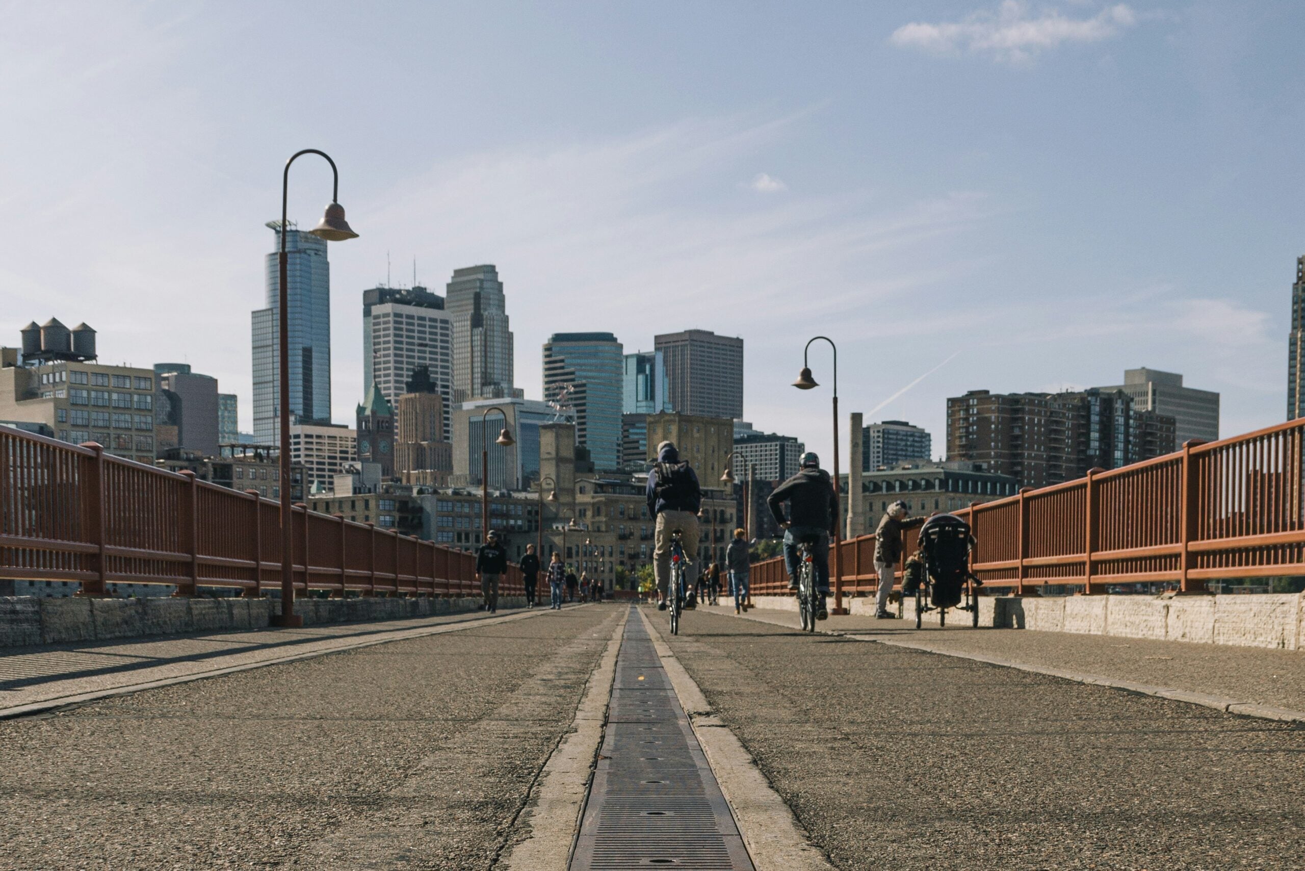
Picture this: you wake up on a Sunday morning and hop on a bike with your family or a close friend. Within a few minutes you arrive at a coffee shop, order your drink of choice while listening to the murmurs of the nearby farmer’s market. Today’s mission is the local art museum, accessible by bike and nestled on a main thoroughfare that cuts through your neighborhood. You’re imagining lunch at one of the many options within a short walk from the museum. And you feel a sense of safety, because you know that if you accidentally fall on your bike, urgent care isn’t far away.
It wasn’t always like this, though. After construction of a new highway divided the neighborhood, you and your neighbors spent years advocating for the amenities that make your neighborhood thrive. You also took steps to ensure that even as your neighborhood redeveloped, existing neighbors wouldn’t be priced out and could stay to enjoy the new amenities.
For some, this may sound like a familiar process or even like your own neighborhood.
Communities across the United States — and the world — are working towards similar visions of thriving, walkable communities, where kids can safely cross the road or bike to school, and where they don’t have to drive halfway across town to reach jobs or essential services like grocery stores or healthcare providers.
Over the past two years, NUMO, the New Urban Mobility Alliance, worked to realize this vision with 15 city-based community coalitions and local government partners across the country through the Community Connectors program. Supported by the Robert Wood Johnson Foundation and implemented in collaboration with Equitable Cities, NUMO and America Walks, Smart Growth America’s Community Connectors supports and funds leaders in small and mid-sized communities — in and out of government — to repair the damage of divisive infrastructure.
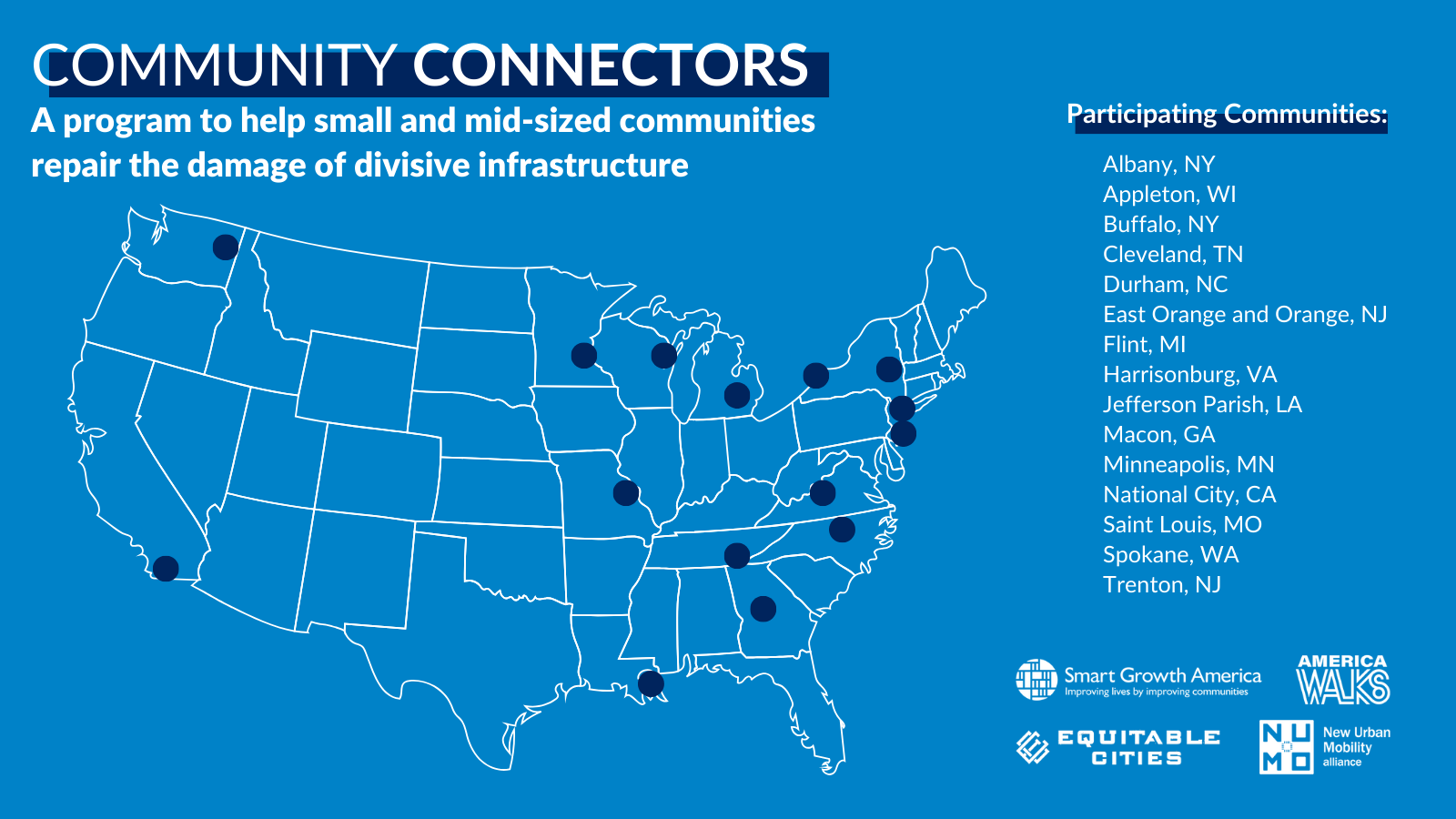
As part of this effort, NUMO’s experts conducted spatial analyses in nine of these cities to help visualize the specific barriers and opportunities faced by communities in their day-to-day lives caused by divisive and unsafe infrastructure — an essential first step toward more inclusive redevelopment.
Below, we share four snapshots that demonstrate how communities can use data to identify opportunities for more connected, equitable and thriving neighborhoods. Each example highlights a core element of community well-being: climate resilience, access to economic opportunity and education, equitable development, and safe mobility infrastructure that connects neighborhoods to key urban features.
Together, these snapshots also show what has held communities back: Autocentric development has divided neighborhoods, stripped away local amenities and driven sprawl — outcomes that run counter to people-centered, thriving communities.
Creating Equitable Access to Warming Shelters in Buffalo, New York
Sitting at the easternmost crest of Lake Erie, Buffalo gets some of the highest snowfall in the Northeastern United States. In winter 2022–2023, the city experienced 133.6 inches of snow. This extreme weather poses substantial risks to infrastructure and vulnerable populations, especially people experiencing homelessness. To mitigate the impacts of extreme cold on Buffalo’s unhoused population, the city developed a cold weather emergency safety plan that includes warming shelters.
The Buffalo Community Connectors coalition wanted to better understand environmental justice issues broadly, a part of which was mapping accessibility and walkability to the city’s warming centers. The city of Buffalo provides a suite of cold weather resources, including those for cold weather emergencies. While there are many extreme cold warming centers, many of them have limited hours. Our analysis focused on shelters that have overnight and weekend hours.
The map below shows the average walking distance for Buffalo residents to reach a warming shelter in winter 2024–2025. Most of the city had over a 30-minute walk to warming shelters, which are concentrated downtown. There is a large shelter gap in northern and southern Buffalo, indicating an opportunity to establish additional shelters in the coming years.
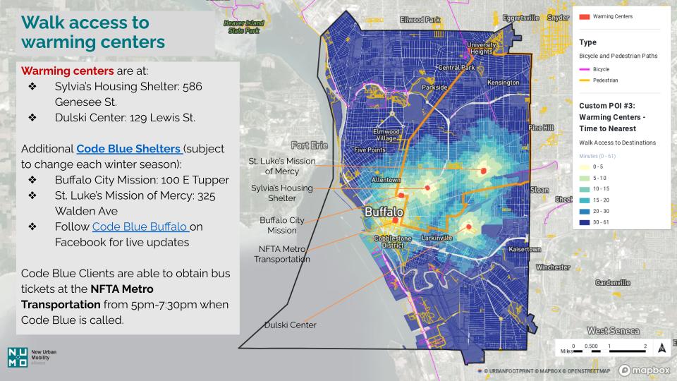
Social well-being is a key tenant of thriving communities. As climate changes, extreme weather events become more common; including instances where the polar vortex stretches, resulting in extreme cold events in lower latitudes. As we think about thriving communities of the future, climate injustices such as lack of access to warm shelter will be key for northern cities.
Impacts of Highway Development in Spokane, Washington
In 1961, when highways were built across the United States as a result of the Federal Highway Act, construction of Interstate 90 (I-90) split Spokane’s East Central neighborhood in half, destroying parks, businesses, walkable blocks and more than 650 homes.
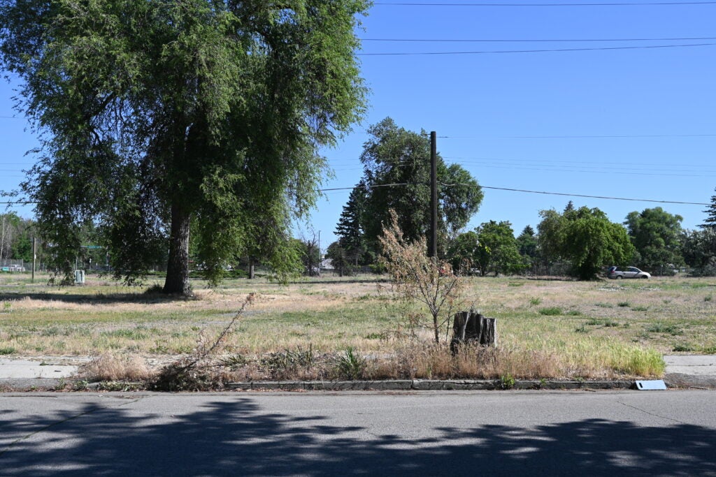
In response, Spokane’s community coalition, Fifth Avenue Forward, aims to revitalize the diverse East Central community. NUMO partnered with Fifth Avenue forward to understand East Central’s accessibility to key amenities — including schools, grocery stores, pharmacies, green spaces and more — within walking distance from home.
The maps below show our walkability and accessibility analysis of the East Central neighborhood and its surrounding areas, including Downtown Spokane. Results show that Downtown Spokane is the most well-resourced area of the city, while residents in East Central are unable to access several key amenities within a 15-minute walk.
By identifying where urban services were inaccessible within walking distance, NUMO was able to recommend areas for future development that could increase accessibility for residents of the East Central community.
Accessibility to economic opportunities and education are key ingredients for thriving communities. In Spokane, most of these opportunities are centralized in the urban core. Increasing opportunities for businesses outside of central districts, coupled with more reliable and resilient mobility infrastructure, can connect residents to critical amenities like jobs.
Connecting History to New Development Patterns in Albany, New York
Albany has a rich Black history: at the beginning of the 1800s, free African Americans established a thriving community, even as slavery remained legal in New York State. By 1830, the city was a hub of the abolitionist movement and a key site along the Underground Railroad.
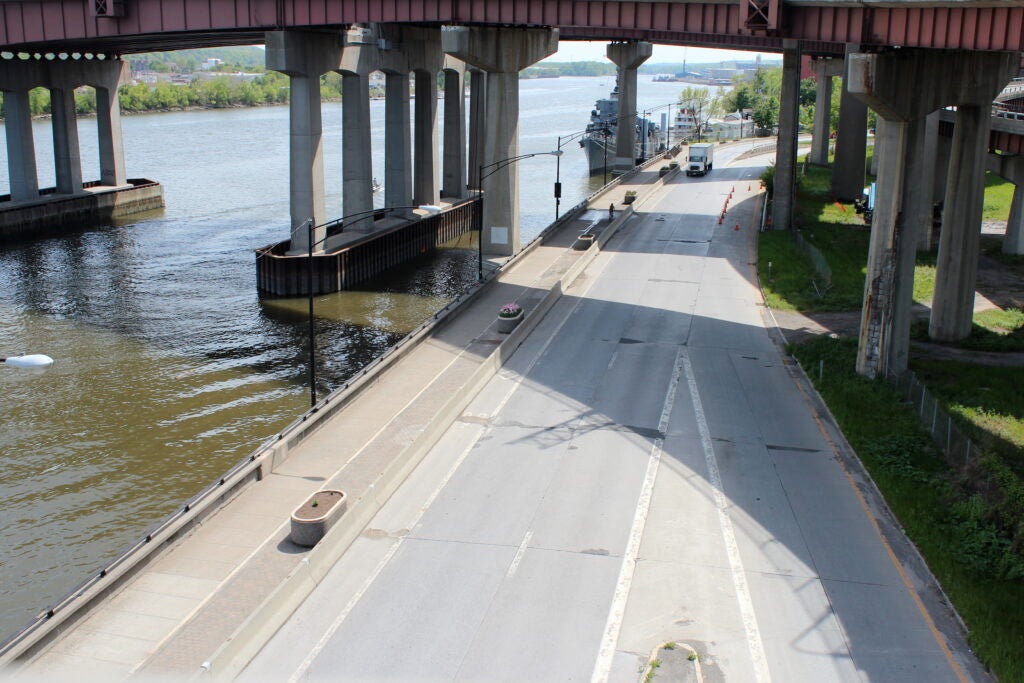
The city and New York Department of Transportation plan to redevelop Interstate-787 (I-787) to allow better access to the Albany waterfront. Proposed options include boulevard designs and an underground tunnel, opening space for parks, housing and commercial development. The Albany Riverfront Collective aims to ensure future displacement does not occur and that amenities develop equitably. Previous revitalization around the construction of Empire State Plaza in the 1960s displaced more than 7,000 residents. As such, the Albany community coalition wanted to know how to develop in a way that serves existing residents and supports their neighborhood to thrive.
To answer this question, we conducted an analysis of risk factors — including high rent burdens, presence of populations of color and low incomes — to identify the neighborhoods most vulnerable to displacement in Albany.
Our analysis revealed that neighborhoods with high risk factors not only house all the sites of Black historical significance but are also seeing the most market-rate housing construction in recent years. Antithetical to thriving neighborhoods, racial discrimination has historically been baked into land-use policy. Often, large, single-family lots are the only type of housing built and available in more affluent neighborhoods, pushing new multifamily development into poorer areas. Combined with practices like redlining, where loans were often denied for homes in minority areas, zoning divides occurred along racial lines.
In Albany, restrictive zoning policy and resident pushback in wealthier areas of cities has pushed development into lower income neighborhoods, creating the potential for displacement of existing residents. Studies show that market-rate housing is an important factor in bringing down rent prices; however, when placed in lower-resourced areas they tend to gentrify the neighborhood and put pressure on existing residents.
Given the high potential for displacement, this analysis can champion intentional programs and policies that support existing residents and counter any potential impact of new investment in the community. Thriving communities ensure that new development is equitable and historically informed, so neighborhoods can be diverse and integrated.
Harnessing Highway Re-Design Opportunities in Trenton, New Jersey
Trenton’s Route 29 runs directly along the Delaware Riverfront. During the Federal push to develop highways across the country in the 1950s, part of Route 29 was converted into a four-lane highway. This development increased speeds to rush people from Trenton’s suburban fringe to the downtown core. In the process, several pieces of non-highway infrastructure were destroyed including Stacy Park and a working canal. The Delaware River — once a cultural and community asset for Trenton’s residents — was made inaccessible.
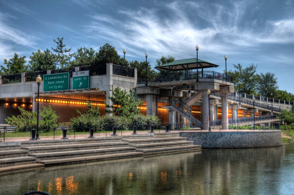
Responding to longstanding community calls to reconnect Trenton to its waterfront, and with support from Community Connectors, the city partnered with Mercer County, state agencies and local nonprofits like New Jersey Future to develop a proposal to the U.S. Department of Transportation’s Reconnecting Communities Pilot Program to convert the highway into a boulevard. To support local advocates reimagining a more connected waterfront, NUMO conducted a walkability analysis that revealed limited access to the Delaware River through downtown.
While new analysis is valuable, turning ideas into concepts — and concepts into design — requires time, resources and space for the community to imagine what’s possible. When that investment comes together, the results can be transformative. For example, in Ohio, the Cincinnati John G. and Phyllis W. Smale Riverfront Park is a great example of a public-private partnership bridging the life of downtown Cincinnati with the Ohio River. The project enhances green space, multi-use pathways and connections to key bridges and sports venues — work that had a regional economic benefit of $1.2 million.
The Trenton Capital City Redevelopment Plan is heading in a similar direction. As they boulevard Route 29, they plan to make the area safer for bikers and pedestrians, reconnect the city network to the boulevard, expand the waterfront park and develop mixed-income, mixed-use housing.
Implementing Land-Use Analysis
From improving connectivity for pedestrians and cyclists in Spokane and Trenton to highlighting Black history while mitigating displacement in Albany to protecting vulnerable residents from extreme weather in Buffalo, NUMO’s analyses gave community coalitions clear visualizations to use in their advocacy efforts.
Of course there are caveats to any analysis.
First, analyses centering geographical data and maps are often 2-D representations of a variegated and complicated world that do not always reflect peoples lived experiences. Collaborating with people on the ground is key to understanding when a parking lot you’ve highlighted as a key redevelopment site is actually a critical spot for church on Sundays.
Second, we can’t predict displacement (at least with the kinds of data that are currently available), but we can highlight at-risk neighborhoods and encourage policy and practice to avoid and mitigate displacement in those areas.
Finally, in our analyses we were able to map walk volume and how far a walk someone must take to access key amenities from a particular parcel, but we did not have information about the availability or quality of pedestrian infrastructure. Understanding if a sidewalk exists or is accessible would be an important next step in providing recommendations about key infrastructure upgrades.
Given that many of these community coalitions are in the early stages of their projects, the upfront visioning work they are doing is essential to establish clear objectives and strategies for creating more walkable and thriving neighborhoods. They are putting in the hard work to break the long cycle of car dependency in the U.S., which divides communities, displaces residents and locks urban planners into a cycle that prioritizes space for personal passenger vehicles and the expanding infrastructure that comes with them.
Creating truly thriving and resilient communities in the United States begins with recognizing the deep interdependence between land use and the daily needs of residents. Are residents’ basic needs (food, water, jobs, shelter) able to be met within a 15-minute walk? Is there access to life-saving healthcare? Are opportunities for cultural, social and educational enrichment within reach? The analyses shared throughout this piece demonstrate how land‑use decisions shape every facet of community well‑being. When cities center community voices and pair lived experiences with data‑driven insights, they can better identify where infrastructure divides people from opportunity and where strategic investments can repair past damage.
As coalitions across the country continue their early‑stage visioning, the path forward becomes clear: building walkable, connected, equitable neighborhoods requires intentional land-use planning that supports climate resilience, expands access to essential services, protects residents from displacement and reconnects communities long separated by autocentric development. By enacting intentional land-use planning, city leaders and community partners can lay the foundation for urban environments where all residents can thrive.
Justyn Huckleberry is Projects & Research Associate for NUMO at WRI Ross Center for Sustainable Cities.
Ben Holland is Senior Manager for NUMO at WRI Ross Center for Sustainable Cities.
Jyot Chadha is Deputy Director of NUMO at WRI Ross Center for Sustainable Cities.