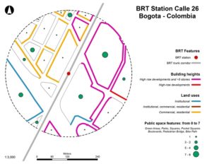
This map shows built environment data collected around the BRT station Calle 26 in Bogotá, Colombia, including information about non-motorized transport infrastructure and mixed land uses. Cities can use this type of on-the-ground data to better inform decision making and determine how the built environment around BRT stations can influence ridership.


