Posts tagged with 'pedestrian-friendly maps'
With 5,000 years of history and culture, the city of İzmir along the Ionian Coast is one of Turkey’s most remarkable urban areas. It’s a unique nexus between the past and present, with a variety of archaeological conservation sites but also Turkey’s ...

In order to encourage walking and re-educate the public on transportation choices, members of a new campaign in Raleigh, North Carolina placed unsanctioned street signs designating the amount of time it takes to travel to key destinations by walking. “Walk ...

HopStop, a provider of pedestrian navigation and mobile transit routing services, released the Urban Travel Patterns infographic last week. The infographic gives insights into how commuters in more than 68 major metropolitan areas across 150+ cities travel. “Based on more than 400 million ...

HopStop, a location-based pedestrian navigation service, in partnership with Enriched Media, is introducing a new small business advertisement program that offers local merchants, tourist attractions and event organizers in New York City free geo-targeted advertising. Local businesses and event planners ...

Hansel and Gretel may have had bread crumbs to lead their way, but New York City’s pedestrians will have something less edible to follow: Maps! Taking a page from London’s pedestrianization efforts, New York City’s Department of Transportation released a ...

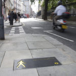
Transport for London (TfL), the government body in charge of Greater London’s transit system, installed pedestrian-friendly maps in strategic decision-making spots, like subway entries and bus stops, to encourage walking. In addition to being a healthy and environmentally friendly mode ...


