Posts tagged with 'GPS'
Moving around cities in a variety of ways is getting easier and more convenient: whether it’s improved public transportation systems, wider sidewalks or more dedicated bike lanes. With the rise of smartphone technology and GPS, shared mobility services — like ...

Rafaela Aires’s workday starts at 9:00 a.m., leading her down city streets that weave past the Atlantic shoreline and under concrete overpasses. Her collected bottles and cardboard boxes used to form heaps in a hand-drawn cart. Now, they rattle in ...

In many cities, lockdowns have forced large numbers of people into an impossible dilemma: follow social distancing guidelines or be deprived of their livelihoods and basic services. Unlike most places, South Korea and its capital, Seoul, took a markedly different ...

Over the past decade, many transit agencies in Indian cities have implemented information technology services (ITS) to improve bus planning and operations in urban areas. These typically require huge investments financed either by the city government or by the transit ...

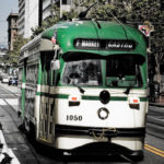
Picture yourself on a lazy Sunday afternoon cruising down San Francisco’s Market Street in one of the city’s iconic streetcars. You have a seat to yourself to peer out the window as the sun beats down over the Golden Gate; ...

Researchers at Carnegie Mellon University released a new smartphone application that will help transit users create a database of real-time information of their local transit agencies. Cities and transit agencies around the world are making riding easier for their customers by ...

IBM, along with the California Department of Transportation (Caltrans) and California Center for Innovative Transportation at the University of California, Berkeley, announced a new effort to develop an intelligent transportation solution in managing traffic flow. The application, accessible through compatible smart ...

Do you want to be able to map your bike routes as you ride and share them with fellow riders? Impress your friends by locating the closest Zipcar on the spur of the moment? Find the nearest subway station in ...


