


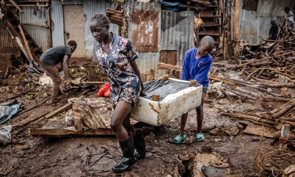
As of May 2025, approximately 500,000 people had been displaced by severe flooding across Kenya. Informal settlements bear a disproportionate burden of flood-induced displacement due to their location in environmentally fragile areas, unplanned development and limited access to climate-resilient infrastructure and housing.
Mukuru, Nairobi’s second largest informal settlement, has long faced recurrent flooding and displacement, with the March–May (MAM) rains of 2024 and 2026 causing particularly devastating impacts. In March 2026, intense rainfall triggered widespread flooding across parts of Nairobi, overwhelming drains and causing the Nairobi and Ngong rivers to burst their banks. Homes, businesses and critical infrastructure were submerged and destroyed, displacing over 500 families in Mukuru.
Flood-induced displacement unfolds against the backdrop of government-led forced evictions along Nairobi’s riparian reserves. Yet, in Mukuru, the decision to stay is not simply a consequence of limited alternatives; it can also be a deliberate decision bolstered by strong social ties, deep attachment to place, and local knowledge and strategies for coping with recurrent floods.
To better understand these dynamics, Nuvoni Centre for Innovation Research conducted participatory mapping and storytelling sessions with Mukuru residents to explore how flooding shapes human mobility, displacement and decisions to move or stay.
Understanding Flood Risk in Mukuru
Mukuru is home to 700,000 people living in approximately 2.5 square kilometers of land. The settlement is traversed by the Ngong River, which flows from west to east. The Nairobi Railway line divides the settlement into two main sections: Mukuru Kwa Reuben and Mukuru Kwa Njenga. Administratively, the settlement is divided into 30 villages.
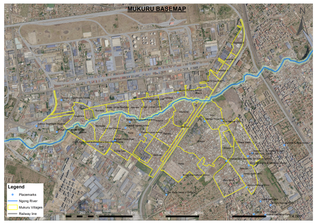
Our digital elevation map indicates that Mukuru lies in a floodplain with an average gradient of 0.4% — less than half of eastern Nairobi’s average gradient of 0.9%. This gently sloping terrain, combined with intense rainfall, proximity to the Ngong River, inadequate drainage, and densely packed, haphazardly located structures, heightens the settlement’s vulnerability to flooding. River backflows further exacerbate inundation during heavy rainfall.
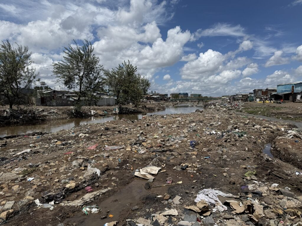
Community accounts revealed how some locally adopted coping measures inadvertently intensify flood risks. Residents described how communal efforts to backfill sections of the Ngong River’s banks can obstruct stormwater flows, worsening inundation and leaving households increasingly exposed during floods. These experiences highlight the complex relationship between local adaptation practices and the environmental conditions that shape their effectiveness.
With an estimated population density of 120,000 people per square kilometer, Mukuru faces substantial challenges in managing flood risks. Our estimates suggest that 120,000 residents are exposed to the adverse effects of flood inundation every year. For affected households, the consequences extend beyond damaged homes and lost property to difficult decisions about whether to move to safer places, stay in flood-prone areas or face the threat of government-led evictions.
Circular Movement as a Temporary Adaptation Strategy
For many Mukuru residents, movement in response to flooding is temporary rather than permanent. During periods of intense rainfall, residents move or evacuate to escape rising waters, returning to their homes once floodwater recedes. Others seek temporary refuge with neighbors, friends or relatives, while some are evacuated by volunteer community disaster responders to nearby schools, churches and social halls serving as temporary shelters.
This recurring pattern of departure and return constitutes a form of circular mobility: residents move away from immediate danger but return when conditions improve. Repeated across successive rainy seasons, this strategy reflects an ongoing effort to manage flood risks while maintaining access to homes, livelihoods and community networks.
Other residents make more lasting moves to safer places within Mukuru, seeking to avoid areas particularly susceptible to inundation.
Yet not everyone leaves when floods occur. Some households have adapted their homes to accommodate reoccurring inundation. These measures include raising furniture above expected flood levels, constructing embankments around homes, elevating floors and foundations, and drilling holes to allow floodwater to flow out more quickly.
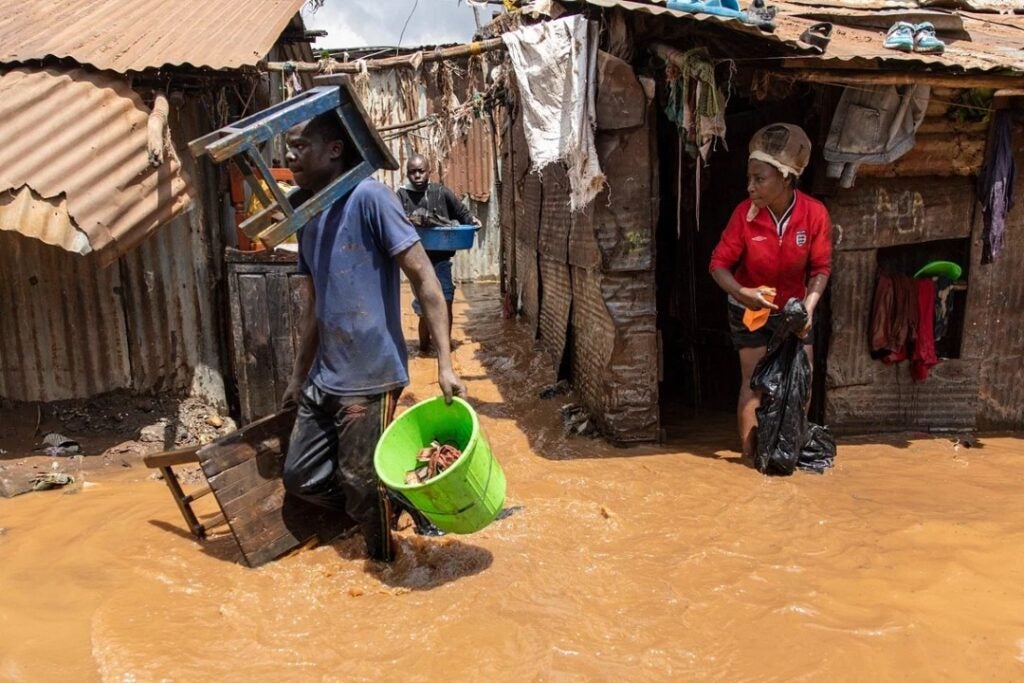
Although such measures may help residents protect their belongings and manage water inside their homes, they do not eliminate the risks associated with recurrent flooding. Continued exposure to contaminated water, damp living conditions and inadequate sanitation can increase the risk of waterborne diseases and respiratory illnesses. These household-level adaptations illustrate both the resourcefulness of residents and the limits of coping strategies that operate in the absence of adequate flood protection and infrastructure.
Why Residents Choose to Stay
Rain brings more than just water to Mukuru: it activates a complex system of local knowledge, social networks and collective survival strategies. Years of repeated exposure to flooding have given residents a deep understanding of how these disasters unfold and how best to respond. As many residents say, “It does not have to rain in Mukuru to flood.” Heavy rainfall upstream can send large volumes of water rushing into the settlement, even when local rainfall is limited.
When floodwater rises, community members respond quickly. From midnight alarm calls to informal monitoring of water levels, residents identify those most at risk and help them reach safer locations.
For many residents of Mukuru, choosing to stay despite frequent flooding is a deliberate decision shaped by strong social ties, deep attachment to place and local knowledge of how to cope with climate-related disasters. Community networks provide critical social and economic support during emergencies and in everyday life. Residents describe a sense of communal unity and collective responsibility that may be difficult to replicate elsewhere: neighbors check on the sick, share resources and help ensure that no one goes to sleep hungry.
These social connections are reinforced by economic considerations. Relatively affordable rent and proximity to informal employment opportunities make Mukuru an important base for households who rely on Nairobi’s informal economy. Moving elsewhere may reduce exposure to flooding but simultaneously increase housing costs, lengthen commutes, disrupt livelihoods and weaken established support networks. Consequently, voluntary movement tends to occur within Mukuru, rather than between settlements or neighborhoods.
However, not everyone who remains does so by choice. Some residents would like to relocate but cannot afford safer housing. Low and unstable incomes, limited access to formal employment and the costs of relocation constrain their options. The elderly and people with disabilities may face additional physical, financial or social barriers to moving.
This distinction between choosing to stay and being unable to leave is critical. While some residents exercise agency by remaining in a place where they have established livelihoods and support networks, others experience involuntary immobility — a situation in which people remain exposed to environmental hazards because they lack the resources or opportunities to move. Even when flood warnings are issued, these constraints can leave vulnerable households with few viable options for reaching safety.
Understanding mobility in Mukuru therefore requires moving beyond the assumption that displacement is always the inevitable response to climate hazards, or that relocation is necessarily the preferred outcome. Residents’ decisions reflect a complex interplay of environmental risk, economic necessity, social belonging, local knowledge and unequal access to safer alternatives.
From Policy Gaps to Resilience
As climate-related hazards increasingly threaten communities across Africa, the needs of people affected by climate-related displacement and those unable to move remain insufficiently addressed. Policy frameworks in Kenya recognize climate-related displacement as a driver of human mobility, but important gaps remain in translating this recognition into effective action for affected urban populations.
In particular, policy and planning approaches need to account for the distinct circumstances of people who move temporarily, relocate permanently or remain in hazardous locations. Insufficient attention to these different mobility outcomes risks overlooking the needs of residents who cannot move, those who choose to stay and those whose movements are constrained by poverty, insecure housing or the threat of eviction. Without measures to address these realities, households may be left relying on coping strategies that reduce immediate harm but do little to mitigate longer-term vulnerability.
Reducing flood risk in Mukuru requires a coordinated approach that combines infrastructure improvements, community knowledge, inclusive urban planning and social protection. Residents have proposed construction of gabions along riverbanks to help stabilize banks and reduce erosion and sedimentation, alongside planting trees along the river corridor. Such interventions should be informed by hydrological assessments and appropriate river management practices to ensure that they improve drainage and do not transfer flood risk to other areas.
Residents also call for collaborative, in-situ slum upgrading that meaningfully incorporates community priorities while improving housing, drainage, sanitation and flood protection without resorting to forced evictions. Where relocation is unavoidable for safety reasons, residents should be consulted and provided with appropriate safeguards, support and viable alternatives.
More broadly, informal settlements like Mukuru require proactive policies that recognize both mobility and immobility as important dimensions of climate adaptation. Priority measures include:
- Inclusive early-warning systems: Strengthen accessible, timely flood warnings that combine formal monitoring systems with residents’ local knowledge and established communication networks.
- Community preparedness and response: Support local disaster responders through training, equipment, resources and coordination with relevant government agencies.
- Safe evacuation and social protection: Establish accessible evacuation routes, suitable temporary shelters and targeted assistance for older people, persons with disabilities and households with limited resources.
- Risk-informed urban upgrading: Improve drainage, river management, housing and essential infrastructure through participatory planning that addresses underlying flood risks.
- Protection against displacement-related harm: Ensure that flood-risk management and riparian interventions incorporate meaningful consultation, due process and safeguards against forced eviction and homelessness.
- Recognition of diverse mobility outcomes: Develop policies that address temporary displacement, circular mobility, permanent relocation and involuntary immobility, while protecting residents’ ability to make informed decisions about their futures.
Ultimately, building resilience in Mukuru requires more than encouraging residents to move away from danger. It requires understanding why people stay, recognizing the social and economic systems that sustain them and addressing the structural conditions that constrain their choices. By combining community knowledge with inclusive planning, effective flood-risk management and stronger social protection, policymakers can help reduce vulnerability while safeguarding residents’ livelihoods, social ties and right to participate in decisions about where and how they live.
Stephen Nyagaya is Research Associate at Nuvoni Centre for Innovation Research.