Posts tagged with 'mobile apps'
Nope, it’s not a typo! We’re talkin’ about Weeels, a new online tool to help you “save time, save money, save energy and save space” by finding people to share a cab with you. Here’s how it works: First, you download ...

Michelle Obama’s team at the Let’s Move! campaign is on a roll this week. On the same day as the Childhood Obesity Task Force released its action plan to the President comes another exciting announcement: As part of the Apps ...

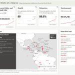
Earlier this month, the World Bank opened up its data and launched a new website – data.worldbank.org – where users will be able to browse and filter more than 2,000 financial, business, health, economic and human development indicators from World ...

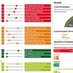
The British newspaper the Guardian has published an interactive tool on its website that allows the user to simulate different policies at the national scale for reducing the UK’s carbon footprint. The user can opt for any number of policies, ...

In less than ten keystrokes, you can now find out the shortest bus route between any two points in Mumbai. Mobile 4 Mumbai, a start-up that works to create mobile solutions, has launched a mobile app that enables users to ...

Cities have been ranked in all kinds of ways. Best places to live, best access to the outdoors, most walkable, most obese, ease of landing a green job, best street art. Now, there’s a new city ranking: Real Simple magazine ...

It all started four months ago, when TheCityFix blogger David Daddio reported an issue on SeeClickFix about a dangerous intersection at U Street and Florida Ave., east of 18th Street NW. Over just several days, the report got responses from ...

Check out this great competition that we came across called NYC BigApps. It launched in October and public voting began yesterday. The competition “will reward the developers of the most useful, inventive, appealing, effective, and commercially viable applications for delivering ...

FrontSeat, the software company that brought you WalkScore, just released a great service called City-Go-Round. The new site is a clearinghouse of useful online and mobile transit applications across the United States. Transit applications and especially open transit data have ...

We wrote about Smarter Cities before, here and here, explaining how the new Web site ranks U.S. cities across categories like transportation and water quality, and also offering suggestions for how NRDC, the creators of the site, should “rebalance its ...

Open source technology: Software companies do it. Why not carmakers? Photo via Riversimple. What if you could revolutionize the way cars are designed and built by opening the process up to input from the entire community? That’s exactly what Riversimple ...

This summer, residents in Chicago and the surrounding region will be asked to plan for their own future, thanks to a collaboration between the Chicago Metropolitan Agency for Planning and a real-life version of SimCity, known as MetroQuest. From the ...

Giant potholes on your route to work? Obstructed views of oncoming traffic? Broken sewer grate? Report these and other non-emergency issues to SeeClickFix.com, a free social networking and online mapping tool (powered by Google Maps) that “provides technology to empower ...

For historical reasons, wireless systems for use in the transportation sector have taken a separate path for technology development. This divergence no longer makes sense. Every other sector in the economy is finding secure, reliable, and economical systems that use ...

In a talk that appealed to computer geeks, policy wonks and transport engineers alike, Prof. Toni Lindau, EMBARQ’s CTS-Brasil Director, discussed his new “Microscopic Bus Rapid Transit Simulator.” Prof. Lindau presented his innovative software tool at EMBARQ’s “Transforming Transportation” event, ...


